Wonder Club world wonders pyramid logo
×

Cartographies of Travel and Navigation Book

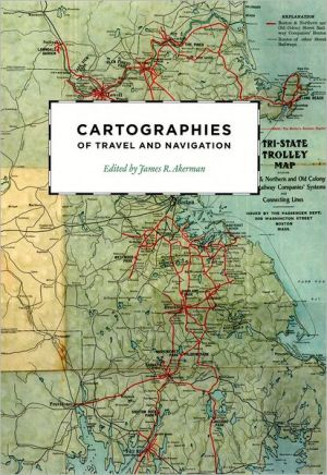
Cartographies of Travel and Navigation
Cartographies of Travel and Navigation, Finding one's way with a map is a relatively recent phenomenon. In premodern times, maps were used, if at all, mainly for planning journeys in advance, not for guiding travelers on the road. With the exception of navigational sea charts, the use of maps b, Cartographies of Travel and Navigation has a rating of 4 stars
   2 Ratings
X
Cartographies of Travel and Navigation, Finding one's way with a map is a relatively recent phenomenon. In premodern times, maps were used, if at all, mainly for planning journeys in advance, not for guiding travelers on the road. With the exception of navigational sea charts, the use of maps b, Cartographies of Travel and Navigation
4 out of 5 stars based on 2 reviews
5
50 %
4
0 %
3
50 %
2
0 %
1
0 %
Digital Copy
PDF format
1 available   for $99.99
Original Magazine
Physical Format

Sold Out

  • Cartographies of Travel and Navigation
  • Written by author James Akerman
  • Published by University of Chicago Press, October 2006
  • Finding one's way with a map is a relatively recent phenomenon. In premodern times, maps were used, if at all, mainly for planning journeys in advance, not for guiding travelers on the road. With the exception of navigational sea charts, the use of maps b
  • Finding one’s way with a map is a relatively recent phenomenon. In premodern times, maps were used, if at all, mainly for planning journeys in advance, not for guiding travelers on the road. With the exception of navigational sea charts, the use of
Buy Digital  USD$99.99

WonderClub View Cart Button

WonderClub Add to Inventory Button
WonderClub Add to Wishlist Button
WonderClub Add to Collection Button

Book Categories

Authors

1Introduction1
2Milieus of mobility : itineraries, route maps and road maps16
3Surveying the seas : establishing the sea routes to the East Indies69
4Mapping a transcontinental nation : nineteenth- and early twentieth-century American rail travel cartography97
5Twentieth-century American road maps and the making of a national motorized space151
6"Up in the air in more ways than one" : the emergence of aeronautical charts in the United States207
7Maps on wheels : the evolution of automobile navigation260


Login

  |  

Complaints

  |  

Blog

  |  

Games

  |  

Digital Media

  |  

Souls

  |  

Obituary

  |  

Contact Us

  |  

FAQ

CAN'T FIND WHAT YOU'RE LOOKING FOR? CLICK HERE!!!

X
WonderClub Home

This item is in your Wish List

Cartographies of Travel and Navigation, Finding one's way with a map is a relatively recent phenomenon. In premodern times, maps were used, if at all, mainly for planning journeys in advance, not for guiding travelers on the road. With the exception of navigational sea charts, the use of maps b, Cartographies of Travel and Navigation

X
WonderClub Home

This item is in your Collection

Cartographies of Travel and Navigation, Finding one's way with a map is a relatively recent phenomenon. In premodern times, maps were used, if at all, mainly for planning journeys in advance, not for guiding travelers on the road. With the exception of navigational sea charts, the use of maps b, Cartographies of Travel and Navigation

Cartographies of Travel and Navigation

X
WonderClub Home

This Item is in Your Inventory

Cartographies of Travel and Navigation, Finding one's way with a map is a relatively recent phenomenon. In premodern times, maps were used, if at all, mainly for planning journeys in advance, not for guiding travelers on the road. With the exception of navigational sea charts, the use of maps b, Cartographies of Travel and Navigation

Cartographies of Travel and Navigation

WonderClub Home

You must be logged in to review the products

E-mail address:

Password: