
|
|
The average rating for The Piri Reis map of 1513 based on 2 reviews is 4.5 stars.
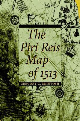
Review # 1 was written on 2014-12-31 00:00:00 Maurizio Adinolfi Maurizio AdinolfiEvery once in a while, the Piri Reis map pops up again as a "proof" for the wildest theories. The map purportedly shows a portion of Antarctica, densely vegetated and much closer to the equator than it currently is situated. It was made by Ottoman cartographer and military admiral Piri Reis in 1513, long before Antarctica was discovered in the 19th century. To explain the apparent appearance of the ice-free Antarctican coastline on the map, it is suggested (by Charles Hapgood, a history professor who brought the Piri Reis map to the attention of the USAF) that there must have been either UFO visitations or ancient civilizations with advanced mapping technology (including aerial photography!) capable of charting the area some time before the ice caps formed, and that Antarctica would have been located much further north than it is now due to a sudden shift of the earth's entire lithosphere. To confute these outlandish ideas, Gregory McIntosh studied the Piri Reis map in depth and concluded that the area in question is not Antarctica at all, but the east coast of South America, bent eastward to keep it all on the same sheet. This is obviously a distortion of the real shape of South America, but then all paper maps are, to some extent - the only accurate map is necessarily a globe. In 1513, Magellan's circumnavigation had not taken place yet; Tierra del Fuego and Cape Horn hadn't been discovered yet and it was anyone's guess how the southernmost tip of the South American continent looked like, or whether there was a southernmost tip at all. The Piri Reis map, argues McIntosh, was simply a compilation of several other, slightly older maps, combining what was geographically known about the New World at that point in time. And now that McIntosh cleared that up, we can appreciate the Piri Reis map for what it is: a beautiful map with inscriptions about the people, flora, fauna, minerals and curiosities of the New World. As Piri Reis included information from Columbus' second voyage to the Americas, this is probably the only surviving map that was directly based on Columbus' own observations. It's not the most accurate historical map of the Americas (the depiction of North America is a terrible mess) but it certainly is a beautiful, fascinating document from those times of exploration - a fine piece of art. |
Review # 2 was written on 2015-05-21 00:00:00 Joselito Angeles Joselito Angelesحظت هذه الشخصية باهتمام كبير من الغرب وتم تعين خراطة بأنها من اهم الخرائط في التاريخ واعجز العلماء في الدقة الشديدة لجغرافية تلك المناطق وحدودها قبل ظهور الاقمار الصناعية. وقبل وقت طويل من اكتشاف القطب الجنوبي في القرن ال19. رسم مظهر واضح للقارة القطبية الجنوبية وصور الساحل خالية من الجليد على الخريطة، يقترح (تشارلز هابجود، أستاذ التاريخ الذي درس خريطة بيري ريس لفت انتباه القوات الجوية الأمريكية أن هناك يجب أن يكون إما زيارات UFO أو الحضارات القديمة توصلت الى تقنية تحديد المواقع المتقدمة (بما في ذلك التصوير الجوي!) فكيف له يكون قادرة على رسم المنطقة قبل وقت ظهور القمم الجليدية و تشكيلها. كتاب مشوق وغني بالمعلومات والأحداث التاريخية المختلفة و أنا متأكد من امكانية الجميع العثور على معلومات مثيرة للاهتمام حول مواضيع هذا الكتاب |
CAN'T FIND WHAT YOU'RE LOOKING FOR? CLICK HERE!!!