
|
|
Sold Out
Sold Out
![]()
![]()
![]()
Book Categories |
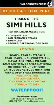
The Simi Hills are a small, rugged mountain range in eastern Ventura County and a portion of Los Angeles County. Well over half of the 77 square miles have been set aside as public or private open space. Numerous trails traverse the hills, with trailhead access from San Fernando Valley, Simi Valley, Conejo Valley, and Ventura Freeway (US 101). This full-color trail map, the first of its kind for the region, shows all public use trails - for hiking, mountain biking, and equestrian use - and all public open space and parkland boundaries within the Simi Hills. The only comprehensive trail map of the Simi Hills shows trail elevations and trail mileages between junctions, includes Points of Interest and facilities (parking, water, restrooms, picnic tables, etc.). Contains latitude-longitude notations and UTM gridlines.
| Price | Condition | Delivery | Seller | Action |
| $99.99 | Digital |
| WonderClub |
Anthony Latimer
reviewed MAP Trails of the Simi Hills on January 04, 2018 MAP Trails of the Simi Hills
First, I love hiking books. This one is well done. The Sandias offer a cool respite from the heat in Albuquerque and a steep workout getting up them. I have hiked a number of these trails and love them.
Login|Complaints|Blog|Games|Digital Media|Souls|Obituary|Contact Us|FAQ
CAN'T FIND WHAT YOU'RE LOOKING FOR? CLICK HERE!!! X
You must be logged in to add to WishlistX
This item is in your Wish ListX
This item is in your CollectionMAP Trails of the Simi Hills
X
This Item is in Your InventoryMAP Trails of the Simi Hills
X
You must be logged in to review the productsX
X
X
Add MAP Trails of the Simi Hills, The Simi Hills are a small, rugged mountain range in eastern Ventura County and a portion of Los Angeles County. Well over half of the 77 square miles have been set aside as public or private open space. Numerous trails traverse the hills, with trailhead , MAP Trails of the Simi Hills to the inventory that you are selling on WonderClubX
X
Add MAP Trails of the Simi Hills, The Simi Hills are a small, rugged mountain range in eastern Ventura County and a portion of Los Angeles County. Well over half of the 77 square miles have been set aside as public or private open space. Numerous trails traverse the hills, with trailhead , MAP Trails of the Simi Hills to your collection on WonderClub |