
 |

|

Sold Out
Book Categories |
| Introduction | iii | |
| Using Current Charts | iii | |
| Reporting Chart Discrepancies | iii | |
| Section 1 | ||
| Visual Flight Rules (VFR) Charts | ||
| Explanation of VFR Terms and Symbols | 1 | |
| Terrain and Obstructions | 1 | |
| Radio Aids to Navigation | 3 | |
| Airports | 3 | |
| Controlled Airspace | 4 | |
| Special Use Airspace | 5 | |
| Other Airspace Areas | 5 | |
| Terminal Area Chart (TAC) Coverage | 6 | |
| Inset Coverage | 6 | |
| VFR Aeronautical Chart Symbols | 7 | |
| Airports | 9 | |
| Radio Aids to Navigation | 10 | |
| Airspace Information | 11 | |
| Chart Limits | 14 | |
| Navigation and Procedural Information | 15 | |
| Railroads | 17 | |
| Roads | 17 | |
| Populated Places Outlined | 18 | |
| Boundaries | 18 | |
| Miscellaneous Cultural Features | 19 | |
| Shorelines | 20 | |
| Lakes | 20 | |
| Reservoirs | 20 | |
| Streams | 21 | |
| Miscellaneous Hydrographic Features | 21 | |
| Coastal Hydrographic Features | 23 | |
| Contours | 25 | |
| Elevations | 25 | |
| Unreliable Relief | 25 | |
| Shaded Relief | 26 | |
| Area Relief Features | 26 | |
| Miscellaneous Relief Features | 26 | |
| Helicopter Route Charts | 27 | |
| Airports | 27 | |
| Radio Aids to Navigation | 27 | |
| Airspace Information | 28 | |
| Navigational and Procedural Information | 30 | |
| Culture | 31 | |
| Hydrography | 31 | |
| Relief | 31 | |
| VFR Flyway Planning Charts | 32 | |
| Airports | 32 | |
| Radio Aids to Navigation | 32 | |
| Airspace Information | 32 | |
| Navigation and Procedural Information | 33 | |
| Culture | 34 | |
| Hydrography | 34 | |
| Section 2 | ||
| Instrument Flight Rules (IFR) Enroute Charts Explanation of IFR Enroute Terms and Symbols | 35 | |
| Airports | 35 | |
| Radio Aids to Navigation (Navaids) | 35 | |
| Controlled Airspace | 36 | |
| Special Use Airspace | 37 | |
| Other Airspace | 37 | |
| Instrument Airways | 37 | |
| Vor LF/MF Airway System (Low Altitude Enroute Charts) | 37 | |
| Airway/Route Data | 37 | |
| Off Route Obstruction Clearance Altitude (Oroca) | 37 | |
| Military Training Routes (MTRs) | 38 | |
| Jet Route System (High Altitude Enroute Charts) | 38 | |
| IFR Aeronautical Chart Symbols | 39 | |
| IFR Enroute Low/High Altitude Charts | 40 | |
| Airports | 40 | |
| Radio Aids to Navigation | 41 | |
| Airspace Information | 42 | |
| Navigational and Procedural Information | 45 | |
| Culture | 46 | |
| Hydrography | 46 | |
| Oceanic Route Charts | 47 | |
| Airports | 47 | |
| Radio Aids to Navigation | 47 | |
| Airspace Information | 47 | |
| Navigational and Procedural Information | 48 | |
| Cultural Boundaries | 48 | |
| Hydrography | 48 | |
| Section 3 | ||
| Terminal Procedures Publication (TPP) Explanation of TPP Terms and Symbols | 49 | |
| New IAP Chart Format | 49 | |
| Pilot Briefing Information | 49 | |
| Missed Approach Icons | 49 | |
| Rnav Chart Minima | 49 | |
| Terminal Arrival Areas (TAAs) | 50 | |
| Alternate Minimums | 50 | |
| Terminal Procedures Publication Symbols | 54 | |
| Standard Terminal Arrival (Star) Charts | 55 | |
| Departure Procedure (DP) Charts | 55 | |
| Approach Lighting System | 56 | |
| Airport Diagram/Sketch | 59 | |
| Instrument Approach Procedures Plan View | 61 | |
| Instrument Approach Procedures Profile View | 63 | |
| Airspace Classes | 65 |
Login|Complaints|Blog|Games|Digital Media|Souls|Obituary|Contact Us|FAQ
CAN'T FIND WHAT YOU'RE LOOKING FOR? CLICK HERE!!! X
 You must be logged in to add to WishlistX
 This item is in your Wish ListX
 This item is in your CollectionAeronautical Chart User's Guide
X
 This Item is in Your InventoryAeronautical Chart User's Guide
X
 You must be logged in to review the productsX
 X
 X

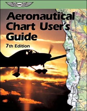
Add Aeronautical Chart User's Guide, This government publication is the most complete reference and source for the legends for all NACO aeronautical charts. Color illustrations and descriptions of all NACO map symbols appear on every page to help pilots understand the charts in order to effi, Aeronautical Chart User's Guide to the inventory that you are selling on WonderClubX
 X

Add Aeronautical Chart User's Guide, This government publication is the most complete reference and source for the legends for all NACO aeronautical charts. Color illustrations and descriptions of all NACO map symbols appear on every page to help pilots understand the charts in order to effi, Aeronautical Chart User's Guide to your collection on WonderClub |