
|
|
Sold Out
![]()
![]()
![]()
Book Categories |
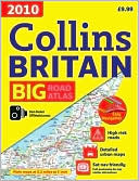
The ultimate 3.2 miles to 1 inch scale large format road atlas for the year 2010 features Collins' popular and well established road mapping, designed for exceptional clarity. A wide range of urban area maps at even larger scale is included, plus 56 detailed town center street plans. Each scale of mapping is color-coded for ease of use. The smallest scale maps are great for long distance route planning and the street plans help you locate your final destination. Also included are fully updated fixed speed camera sites with average speed camera locations clearly highlighted; a map showing the risk rating of Britain's major roads, courtesy of the Road Safety Foundation; World Heritage Sites located with contact details and brief descriptions; and more than 30 categories of places of interest including castles, theme parks, sports venues, universities, mountain bike trails, and surfing beaches.
| Price | Condition | Delivery | Seller | Action |
| $99.99 | Digital |
| WonderClub |
Navinchandra Mehta
reviewed 2010 Collins Big Road Atlas Britain on December 31, 2017 2010 Collins Big Road Atlas Britain
This book is very thorough....perhaps a bit too much. It contains the facts and information, but there is so much that it's not really plausible as a take along guide. It's more for the months-ahead planning read.
It is certainly a good read and good reference, though not as excited as some others.
Login|Complaints|Blog|Games|Digital Media|Souls|Obituary|Contact Us|FAQ
CAN'T FIND WHAT YOU'RE LOOKING FOR? CLICK HERE!!! X
You must be logged in to add to WishlistX
This item is in your Wish ListX
This item is in your Collection2010 Collins Big Road Atlas Britain
X
This Item is in Your Inventory2010 Collins Big Road Atlas Britain
X
You must be logged in to review the productsX
X
X
Add 2010 Collins Big Road Atlas Britain, , 2010 Collins Big Road Atlas Britain to the inventory that you are selling on WonderClubX
X
Add 2010 Collins Big Road Atlas Britain, , 2010 Collins Big Road Atlas Britain to your collection on WonderClub |