Wonder Club world wonders pyramid logo
×

The Mapping of New Spain: Indigenous Cartography and the Maps of the Relaciones Geograficas Book

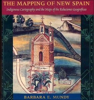
The Mapping of New Spain: Indigenous Cartography and the Maps of the Relaciones Geograficas
The Mapping of New Spain: Indigenous Cartography and the Maps of the Relaciones Geograficas, Although Cortes conquered the Aztec empire in 1521, imperial Spain knew little about the Mexican territory under its control when Philip II acceded to the throne in 1556. As part of a vast project to learn about its territories in the New World, Spain com, The Mapping of New Spain: Indigenous Cartography and the Maps of the Relaciones Geograficas has a rating of 3 stars
   2 Ratings
X
The Mapping of New Spain: Indigenous Cartography and the Maps of the Relaciones Geograficas, Although Cortes conquered the Aztec empire in 1521, imperial Spain knew little about the Mexican territory under its control when Philip II acceded to the throne in 1556. As part of a vast project to learn about its territories in the New World, Spain com, The Mapping of New Spain: Indigenous Cartography and the Maps of the Relaciones Geograficas
3 out of 5 stars based on 2 reviews
5
0 %
4
50 %
3
0 %
2
50 %
1
0 %
Digital Copy
PDF format
1 available   for $99.99
Original Magazine
Physical Format

Sold Out

  • The Mapping of New Spain: Indigenous Cartography and the Maps of the Relaciones Geograficas
  • Written by author Barbara E. Mundy
  • Published by University of Chicago Press, December 2000
  • Although Cortes conquered the Aztec empire in 1521, imperial Spain knew little about the Mexican territory under its control when Philip II acceded to the throne in 1556. As part of a vast project to learn about its territories in the New World, Spain com
  • To learn about its territories in the New World, Spain commissioned a survey of Spanish officials in Mexico between 1578 and 1584, asking for local maps as well as descriptions of local resources, history, and geography. In The Mapping of New Spain
Buy Digital  USD$99.99

WonderClub View Cart Button

WonderClub Add to Inventory Button
WonderClub Add to Wishlist Button
WonderClub Add to Collection Button

Book Categories

Authors

List of Illustrations
Preface
Acknowledgments
Author's Note
Ch. 1Spain and the Imperial Ideology of Mapping1
Ch. 2Mapping and Describing the New World11
Ch. 3Colonial Spanish Officials and the Response to the Relacion Geografica Questionnaire29
Ch. 4The Native Painters in the Colonial World61
Ch. 5The Native Mapping Tradition in the Colonial Period91
Ch. 6Language and Naming in the Relaciones Geograficas Maps135
Ch. 7The Relaciones Geograficas and Other Viceregal Maps in New Spain181
Ch. 8Conclusion213
App. ACatalogue of Maps Studied217
App. BThe Questionnaire of the Relaciones Geograficas227
App. CThe Nahuatl Inscriptions of the Macuilsuchil Map231
App. DA Typical Viceregal Acordado233
Notes235
Bibliography247
Index269


Login

  |  

Complaints

  |  

Blog

  |  

Games

  |  

Digital Media

  |  

Souls

  |  

Obituary

  |  

Contact Us

  |  

FAQ

CAN'T FIND WHAT YOU'RE LOOKING FOR? CLICK HERE!!!

X
WonderClub Home

This item is in your Wish List

The Mapping of New Spain: Indigenous Cartography and the Maps of the Relaciones Geograficas, Although Cortes conquered the Aztec empire in 1521, imperial Spain knew little about the Mexican territory under its control when Philip II acceded to the throne in 1556. As part of a vast project to learn about its territories in the New World, Spain com, The Mapping of New Spain: Indigenous Cartography and the Maps of the Relaciones Geograficas

X
WonderClub Home

This item is in your Collection

The Mapping of New Spain: Indigenous Cartography and the Maps of the Relaciones Geograficas, Although Cortes conquered the Aztec empire in 1521, imperial Spain knew little about the Mexican territory under its control when Philip II acceded to the throne in 1556. As part of a vast project to learn about its territories in the New World, Spain com, The Mapping of New Spain: Indigenous Cartography and the Maps of the Relaciones Geograficas

The Mapping of New Spain: Indigenous Cartography and the Maps of the Relaciones Geograficas

X
WonderClub Home

This Item is in Your Inventory

The Mapping of New Spain: Indigenous Cartography and the Maps of the Relaciones Geograficas, Although Cortes conquered the Aztec empire in 1521, imperial Spain knew little about the Mexican territory under its control when Philip II acceded to the throne in 1556. As part of a vast project to learn about its territories in the New World, Spain com, The Mapping of New Spain: Indigenous Cartography and the Maps of the Relaciones Geograficas

The Mapping of New Spain: Indigenous Cartography and the Maps of the Relaciones Geograficas

WonderClub Home

You must be logged in to review the products

E-mail address:

Password: